Staff report
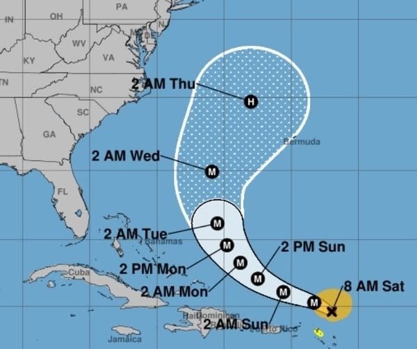
Hurricane Erin has become the first hurricane of the 2025 Atlantic season and rapidly strengthened overnight into a powerful Category 4 storm with winds near 145 mph, according to the latest reports.
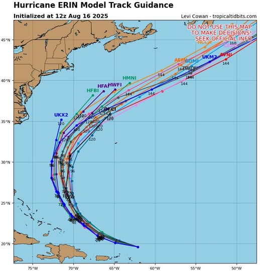
The good news for Florida residents is that Erin is tracking well offshore of the southeastern United States and is forecast to curve north early next week, staying far from the Florida coastline.
“Erin has become a monster 145 mph major category 4 hurricane overnight,” reported the Florida Weather Center Saturday morning. “Current motion is WNW at 20 mph.”
While the storm is expected to remain offshore, forecasters warn that Erin will significantly grow in size over the coming days.
“By the middle of next week, Erin is forecast to at least double or triple in size, which will result in rough ocean conditions over the western Atlantic,” the Florida Weather Center noted.
Weather blogger Mike Boylan of “Mike’s Weather Page” is closely tracking the storm’s projected path, noting that computer models show “confidence on that curve back N/NE, splitting the eastern US and Bermuda gap.”
Residents should continue monitoring official forecasts from the National Hurricane Center as the situation develops.


